 OGReNet Lesson Recipes
written by:
Cam Tsujita
Department of Earth Sciences,
The University of Western Ontario
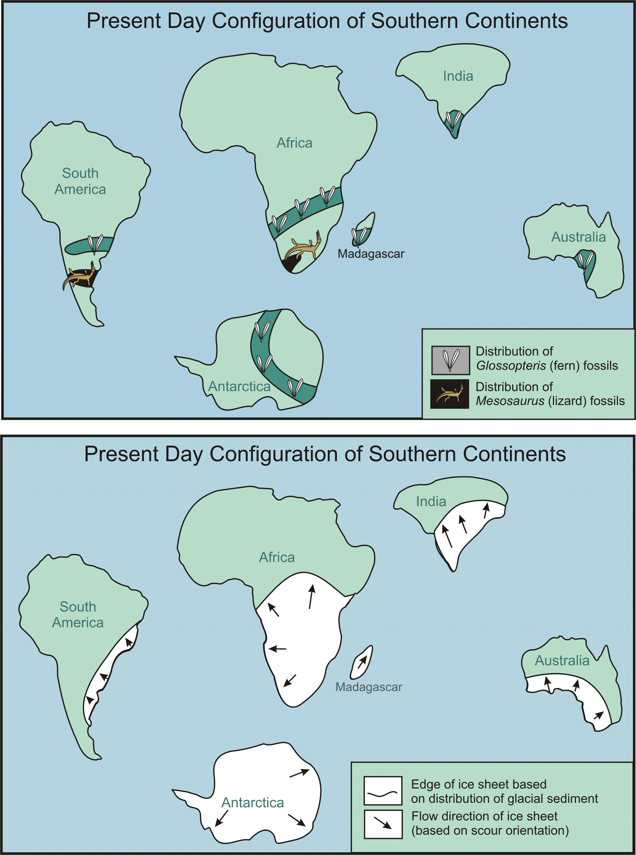
These maps are to be used for the OGReNet "Continental Jigsaw Puzzle" activity. Feel free to print and copy this document. It is suggested that students cut our the continents and try to fit them together. The solution can then be presented on an overhead projector by the teacher (i.e. transparency can be cut and assembled on the projector).
To view these maps at full-size, right click on
the image and click on "View Image". To save the image for later printing
at full size, right click on image and select "Save Image As...".


